>> Good evening. Good evening everybody. I’m chief certified meteorologist Betty Davis tracking Hurricane Milton. And also keeping on top of the weather right outside your door. Broward, Miami-Dade and the keys.
We’re basically dry right now. I am watching some storms over the Gulf of Mexico waters off the southwest coast, and keeping an eye on these to see if they’re starting to work their way eastrd, but they basically just been sort of hovering over the Gulf waters. We’ll keep an eye on it and see how it all evolves. Heading into to the night. Maybe some of these strong storms capable of producing winds gusting to about 40 or maybe even an isolated tornado or waterspouts, maybe some of these storms finally meet up with the southwest coast.
At the very least, I think we’ll have to watch the lower keys to see if some showers and thunderstorms try to build down in your direction, but for now, I think we’ll keep it relatively quiet for the next several hours and possibly through the overnight, especially for Dade and Broward .
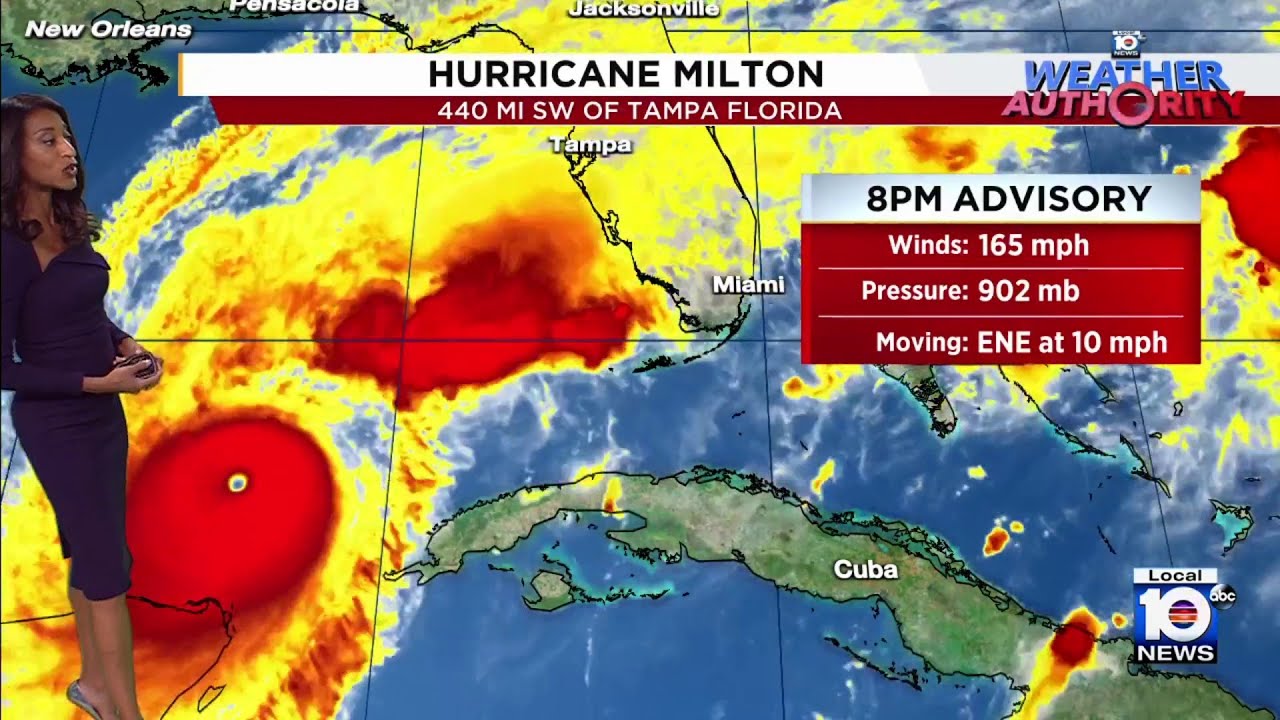
These showers and storms are ahead of Hurricane Milton, so there’s this area of convection . And then here’s Milton. This ball of clouds. You’re noticing over the southern Gulf of Mexico waters.
And that I cannot help but spot that eye of this very powerful hurricane. Maximum sustained winds of 165mph. It is moving east northeast at ten miles per hour. And it’s about 440 miles. At this point, under 440 miles south west of Tampa.
Now as it’s moving east northeastward and closing in on Florida’s west coast, it will be pushing water toward the shore and that water is going to pile up and that will lead to storm surge, a life threatening storm surge forecast for parts of the West Coast and particular from the Tampa area to just south of Sarasota.
The storm surge forecast up to 15ft. Nobody surviving that storm surge. Also a forecast of 1 to 3 for the keys. Of course, that’s minor in comparison to what other areas of the west coast of Florida will deal with.
And by the way, the keys aren’t under a storm surge warning, but that moving into tomorrow, especially at the time of high tide tomorrow afternoon, that takes place around 4:00 for Key West. We’ll look for some of that minor salt water inundation. So there’s the tide forecast for tomorrow. Here’s a look at what we expect for the winds in the keys.
Starting tomorrow morning.
We could start to feel those winds gusting 40 to 50 plus miles per hour. We’ll start to see some of those off and on rain bands starting to work in toward the keys. And South Florida Wednesday night into Thursday. Dade Broward. That’s when I expect our area to start to feel 40 to 50 mile per hour.
Wind gusts won’trillionule out a brief tornado, maybe get a quick spin up in some of the cells that come in with the rain bands.
We’ll have a lot more on.
Read More: The Message


